Floodplain Information

City of Medford's Flood Hazard
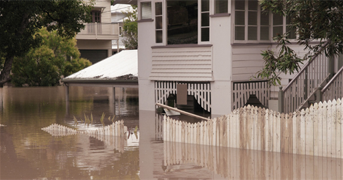
Medford lies at the lower end of a valley drained by Bear Creek. Annual flooding from Bear Creek and its tributaries may pose threats to life and safety and cause significant property damage. Tributaries include Lazy, Larson, Crooked, and Lone Pine Creeks.
Approximately 4.5 percent of the City's land area has the potential of being flooded by the 1% flood (100-year flood). The most recent major flood occurred in 1997. The air temperature in Medford hit 60 degrees on New Year’s eve, and more than three inches of rain fell onto the local hillsides. The unseasonably warm temperatures and the rain were the result of a warm-weather trend known as a “Pineapple Express” from the South Pacific. In all, 8.5 inches of rain fell in less than three days. Damage within the City of Medford was minimal, but this storm was also considered a 30 year storm, which is less severe than the 100 year storm.
To find more information on your flood hazard, contact the City's floodplain management office at 541-774-2380.
Causes of Flooding in the City of Medford
Flooding occurs when climate (or weather patterns), geology, and hydrology combine to create conditions where river and stream waters flow outside of their usual course and “overspill” beyond their banks. In the City of Medford, the combination of these factors, augmented by ongoing development, creates chronic seasonal flooding conditions. Annual precipitation averages 21.1 inches.
Flooding is most common from October through April, when storms from the Pacific Ocean can bring intense rainfall to the area. Larger floods result from heavy rains that continue over the course of several days, augmented by snowmelt at a time when the soil is near saturation from previous rains. Frozen topsoil also contributes to the frequency of floods.
Riverine flooding and urban flooding are the two types of flooding that primarily affect the City of Medford. Riverine flooding is the overbank flooding of rivers and streams, the natural processes of which add sediment and nutrients to fertile floodplain areas. Urban flooding results from the conversion of land from fields or woodlands to parking lots and roads, through which the land loses its ability to absorb rainfall.
Community Rating System
The National Flood Insurance Program Community Rating System ( CRS) is a voluntary incentive program that recognize and encourages community floodplain management activities that exceed the minimum National Flood Insurance Program requirements. The CRS program recognize a community’s efforts to reduce flood risk, facilitate accurate insurance ratings, and promote awareness of flood insurance.
The U.S. Department of Homeland Security, FEMA, has awarded the City of Medford a class five rating, allowing Medford residents to receive a 25 percent discount on flood insurance premiums. Participation in the CRS program acknowledges Medford’s efforts that help save lives and reduce property damage in the event of a flood.
Examples of Medford's involvement in credited activities include:
- Outreach efforts to increase awareness of flood issues in Medford.
- Maintain staff who are trained as Certified Floodplain Managers.
- Provide detailed review of development proposals located within the floodplain.
- Require safe building practices to reduce future flood damage
- Medford Public Works Department operates a drainage system maintenance program
- annual inspections
- regular maintenance of open channels and storm drain systems
Do I need a permit for that?
In most cases, development is regulated if it is within the Special Flood Hazard Area. Check with the Floodplain Manager before you build, grade, excavate or fill on your property. Call 541-774-2380 first.